
Walking up the river from Lake Whakatipu

Thr track follow through some matagouri scrub

This track was very different with cows and sheep grazing the river plains.

View from Mid Caples Hut

The track follows further up the river through grassland before heading through some beech forest.

Upper Caples hut is where I stopped for the night. As soon as I left the hut sandflies swarmed all over me despite my insect repellent.

On the river bank looking over the saddle.
DAY 4: Upper Caples Hut to The Divide

It was great to have some really steep back country track with roots and rocks everywhere in comparison to the perfect great walks tracks.

Sunrise over the mountains

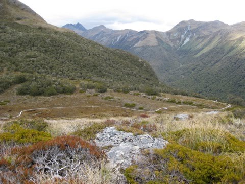
After a couple of hours uphill I made it to McKellar Saddle.

Karen at the top of the saddle
They had a boardwalk to protect some of the fragile alpine plants

I added a rock to the rock tower

The track then had a huge section down over the other side of the saddle before reaching Lake McKellar.
3 December 2010
I had perfect weather over both tracks with hot temperatures and clear blue skies.
The Caples track was mostly through a valley which was given back to Ngai Tahu tribe by the crown. It is now managed by this Maori tribe but the public can still use the tracks.
I reached Lake Howden just after midday and had some lunch with the warden there before walking the 45mins to the divide and driving back to Te Anau. Doing these two tracks together was a great way make a sort of a loop with very different terrain.
No comments:
Post a Comment